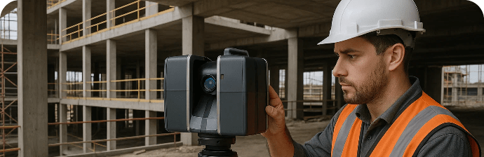
3D Laser Scanning
Every Dimension, Captured in Detail.
LEARN MORE"In Qatar and now Saudi Arabia, Red Link empowers infrastructure and Giga-Mega construction projects with precision services such as 3D laser scanning, land surveying, and All sector staffing solutions serving successfully." We Operate the projects across Construction, oil & gas, etc.

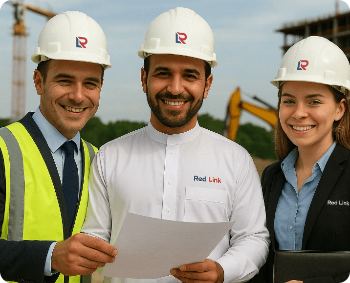
Red Link is a Qatar-based company offering end-to-end services in all the following requirements of diverse sectors with a focus on precision, speed, and reliability. We serve reputed clients across Qatar’s and the wider Saudi Arabia’s regions.
Offering specialized services
3D Laser Scan Survey
Land Survey
Secondment Staff or Contract Staff Supply
"At Red Link, our mission is simple: transform complexity into clarity. Through precision data, agile teams, and ISO-certified excellence, we enable faster decisions, smoother execution, and outcomes clients rely on—every time."
4,000+ Professionals Placed
100+ Clients Satisfied
150+ Landmark Projects Completed
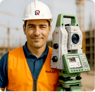


2 Million Points per Second. Zero Room for Error.
Red Link captures complex site geometry with LiDAR-based laser scanners—delivering BIM-ready
models, clash detection
insights, and true as-built accuracy.
Smart Data. Real Terrain. Seamless Execution.
From boundary checks to infrastructure alignment, Red Link’s expert teams use drones, GNSS,
and total stations to
deliver survey data with certified precision.
Right Skills. Real Impact. On-Site, On Time.
Red Link deploys licensed engineers, inspectors, and HSE professionals directly to your
project site—ready to contribute
from day one without onboarding delays.

Our clients trust us because we deliver data without doubt, staff without lag, and results without compromise.

Years Experience
Team Of Advisors
Projects Executed
Satisfied Clients


Red Link services are site-tested and sector-tailored, ensuring that every industry benefits from our experience, safety focus, and adaptability.

Red Link’s land data helped us prevent a costly design error. Their responsiveness made a real difference to our construction schedule.
When you need a site team deployed fast—with skill and accountability—Red Link delivers. We’ve extended their contracts multiple times.
Their laser scanning output integrated perfectly with our BIM model. It wasn’t just data—it was actionable clarity.


Our insights library helps engineers, planners, and project heads stay informed with practical knowledge.
Red Link specializes in three core services: land surveying, 3D laser scanning, and secondment staff supply. Our surveying and scanning solutions deliver high-precision geospatial data for design, development, and compliance. Our staffing services provide project-ready professionals to support engineering, infrastructure, and government initiatives across Qatar.
We combine advanced technologies like GNSS receivers, robotic total stations, and UAV drones with experienced, licensed surveyors. From topographic mapping and boundary demarcation to as-built verification and volumetric analysis, our survey outputs are regulation-compliant, CAD/BIM-compatible, and trusted across industries for accuracy and efficiency.
Red Link uses LiDAR systems, terrestrial scanners, and drone photogrammetry to capture site data with sub-centimeter accuracy. We produce point clouds, mesh models, and BIM-compatible files that help architects, engineers, and facility managers plan, validate, or retrofit with confidence. Our scans are geo-referenced, fast-turnaround, and tailored to each project’s scope.
Red Link deploys qualified and trade-tested professionals for both short- and long-term projects. Roles include civil and planning engineers, land surveyors, quantity surveyors, HSE officers, CAD/BIM designers, document controllers, and site supervisors. Each professional is onboarded, insured, and fully managed by Red Link to ensure seamless client integration.
Yes. Red Link works closely with government agencies and public contractors to deliver surveying, digital modeling, and secondment services for roads, drainage, zoning, utilities, and public transport. We understand the regulatory landscape and provide documentation, staff, and technical outputs that meet Qatar’s infrastructure compliance and planning standards.
Red Link supports a wide range of sectors including construction, real estate, logistics, oil & gas, infrastructure, public works, manufacturing, and urban planning. Our services are tailored to each industry’s pace, safety requirements, and technical needs—ensuring accurate data, field-readiness, and seamless staff deployment at every stage of a project.
Our scanning outputs include high-resolution point cloud files (.rcp, .e57, .las), 2D CAD drawings, mesh models, and BIM-ready 3D models compatible with Revit, AutoCAD, and Navisworks. Clients also receive geo-referenced site documentation and digital walkthroughs—ideal for approvals, renovation planning, facility management, and infrastructure compliance.
We maintain a robust pool of pre-vetted, project-ready professionals. Depending on role and location, we can deploy engineers, surveyors, and support staff within 7 to 12 working days. All staffing comes with full HR support, documentation, and onboarding to ensure fast integration into your team and no project delays.
We use a combination of GNSS receivers, robotic total stations, UAV drones, LiDAR systems, and 3D laser scanners. Our software stack includes AutoCAD, Civil 3D, Revit, Cyclone, and Navisworks. These tools enable us to deliver precise, BIM-compatible outputs for terrain mapping, utility layouts, and as-built documentation.
You can reach us through our Contact page, where you’ll find a quick inquiry form for proposal requests. You may also email us at info@redlinkgroup.com or call us directly at +974 4416 0101. Our team will follow up to understand your project scope and schedule a site visit or consultation.
Whether you're breaking ground, retrofitting, or scaling operations—Red Link delivers data you can trust and people who perform from day one.
Our expertise in land surveying, 3D laser scanning, and technical staffing supports every phase of your project—with speed, clarity, and compliance built-in.
Let’s align your site reality with your project vision.

Red Link Trading & Contracting W.L.L. is Qatar’s trusted partner for precision Land Surveying, 3D Scanning, and Technical Staffing. We empower infrastructure projects with data accuracy, digital insight, and on-ground expertise.
Built in Qatar | Managed by Moris Media